Adventures in California
Contents
The Story
While on business in
The Wreckage
|
|
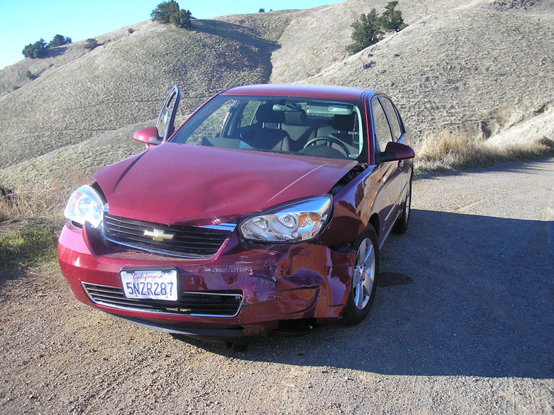
This is my rental car, a
Chevy Malibu. I’ve moved it from its
original position in the road onto the shoulder to allow other cars to get
past the scene. Note the angle of
impact. Thanks to the seat belt and
the airbag I was not significantly injured, though quite sore for a while. |
|
|
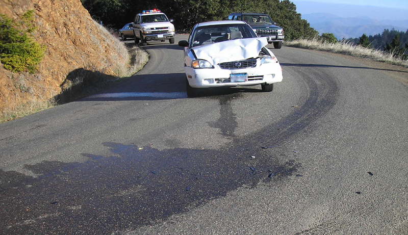
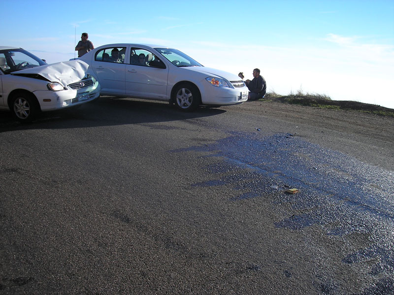
This is the other car, a
Suzuki Esteem, with |
|
|
This is a shot across the
“impact zone”. Again, the other car is
just passing by. You can see the
driver (left) and passenger of the other car sitting on the edge of the
shoulder behind it. The driver had a “displaced fracture” of her left elbow
(maybe from the airbag?), the passenger (who was asleep prior to the
collision, with airbag but no seat belt) had abrasions on his nose and
knee. You can also see various bits of
car strewn through the coolant puddle, and, in the foreground, the yellow
marker for the center of the road. |
Where it happened
|
|
This is from Google Maps. The
green “pin” is the site of the accident.
The red one is |
|
|
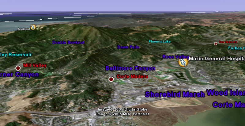
Here’s an aerial
perspective, courtesy of GoogleEarth. This is a satellite photo, processed
together with contour data. The
mountain at left center is |
|
|
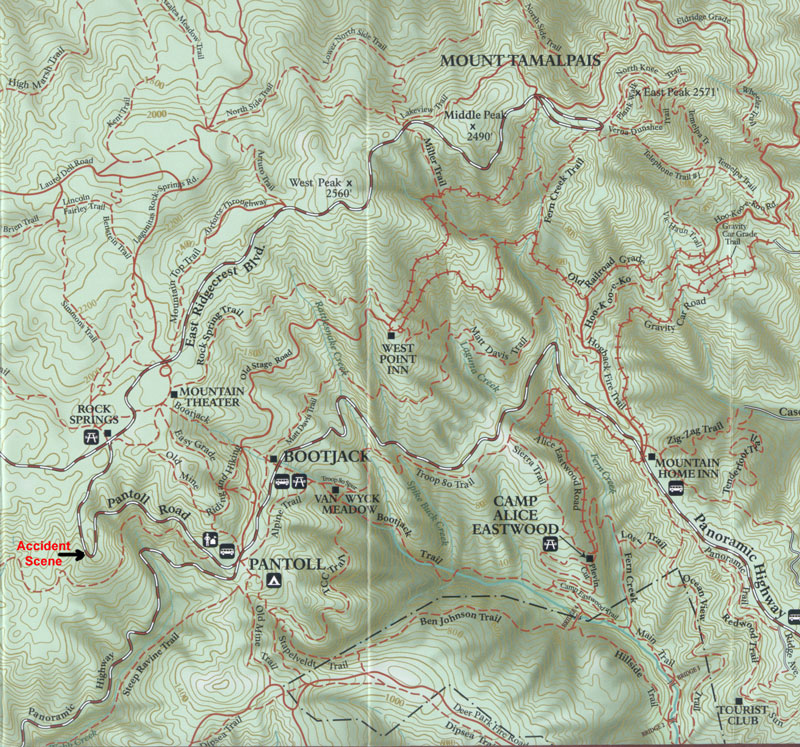
A contour map of the area,
from the trail map for |
|
|
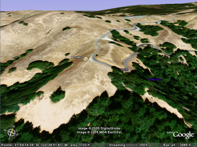
A close-up aerial
perspective view, again from GoogleEarth. Note how there is no shoulder on this road,
except right at the outside of the corner where the collision occurred, where
it is almost certainly to allow cars to get off the road while admiring the
view, which is clear out to the Pacific, though the shore itself is blocked
by the hills. |
|
|
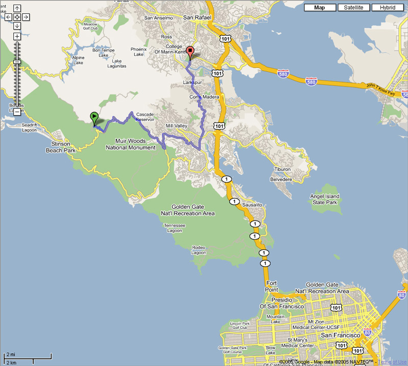
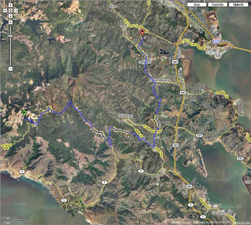
Another image from Google Maps, combining the road map showing the route
from the accident to the hospital with the satellite photo. |
The Official Accident Report
I find this in complete agreement with my view of the accident, except that the shoulder is described as “asphalt” when it is obviously gravel.
![Page 1 [ operator info ]](Adventures%20in%20California_files/Page1.gif)
![Page 2 [ collision details ]](Adventures%20in%20California_files/Page2.gif)
![Page 3 [ injuries ]](Adventures%20in%20California_files/Page3.gif)
![Page 4 [ collision diagram ]](Adventures%20in%20California_files/Page4.gif)
![]() Page 5 [ accident scene
diagram ]
Page 5 [ accident scene
diagram ]
![Page 5 [ accident scene diagram ]](Adventures%20in%20California_files/Page5.gif)
![]() Page 6 [ officer's
narrative ]
Page 6 [ officer's
narrative ]
![Page 6 [ officer's narrative ]](Adventures%20in%20California_files/Page6.gif)
![]() Page 7 [
evidence/conclusions ]
Page 7 [
evidence/conclusions ]
![Page 7 [ evidence/conclusions ]](Adventures%20in%20California_files/Page7.gif)
![Page 8 [ cause ]](Adventures%20in%20California_files/Page8.gif)